Rivers in Afghanistan
Afghanistan has a mainly dry climate, but the country does have many rivers. These are often used in agriculture, or as a main water source for the country.
List of rivers
Here are the main rivers in Afghanistan (more than 400 km long):
| Name | Length | Origin | Description | Image |
|---|---|---|---|---|
| Arghandab river | 400 km (250 miles) | Hazarajat (north-west of Ghazni) | The Arghandab river is used for agriculture. Its lower course is irrigated and the surrounding valley is cultivated and populous. Dams have been created to regularly irrigate the land. In the hot season, the river almost dries up. |  |
| Amu Darya river | 2,400 km (1,500 miles) | Lake Zorkul, Tajikistan and Vaksh river, Kyrgyzstan | The Amu Darya is one of the longest rivers in Central Asia. Its source is north of Afghanistan, in Kyrgyzstan and Tajikistan. It touches the country's northern boundary, in the Jozjan, Balkh or Kunduz regions. |  |
| Farah river | 560 km (350 miles) | Band-e-Bayan range, Ghor province | The Farah river is a very irregular river, like many other rivers in Afghanistan, with an outflow depending on the years and the seasons. The river generally has a high outflow from February to May. |  |
| Gomal river | 400 km (250 miles) | Katawaz region | 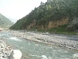 | |
| Harut river | 400 km (245 miles) | South-east of Herat | ||
| Hari/Herat river | 1,100 km (680 miles) | Baba mountain range | 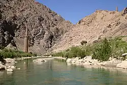 | |
| Helmand river | 1,150 km (710 miles) | Lake Hamun |  | |
| Kabul river | 700 km (435 miles) | Attock, Sanglakh range |  | |
| Khanabad river | 400 km (250 miles) | South-east of the Takhar province | ||
| Kunar river | 480 km (298 miles) | Jalalabad, Hindu Kush |  | |
| Murghab river | 850 km (530 miles) | Central Afghanistan, Ghor province |  | |
| Panj river | 921 km (572 mi) | Confluence of the Pamir and Wakhan rivers |  | |
| Salang river | 438 km (270 miles) | Salang pass |
This article is issued from Vikidia. The text is licensed under Creative Commons - Attribution - Sharealike. Additional terms may apply for the media files.